Hiking San Gabriel Peak

by Modern Hiker on January 28, 2007

A short, steep, switchback-sprinkled trail up the north face of Mount Disappointment to San Gabriel Peak. You’ll pass an old Nike Missile Station and end your hike on a small peak with some nice 360-degree views. This is a fairly easy, shaded, and short hike, with great views (on clear days) and several opportunities to knock some other peaks off your list.


null null null

With my usual hiking partner out of town exploring the wonders of central Arizona, I figured I’d give one of my old friends from home a call and see if he would be interested in running around in the mountains with me.

Lucky for me, he was down.

Remembering last week’s semi-rugged scale up the sides of Mount Lawlor, I was looking for something a bit less intensive. It also rained for much of Saturday night, so I didn’t want to go too high in elevation, just in case my ice-driving skills weren’t quite as good as I think they are.

So I picked up Chris in Los Feliz in the morning, and gave him two options – Mount Lukens, the highest point in the City of Los Angeles (and member of the List of Peaks I Haven’t Climbed Yet), or San Gabriel Peak, the highest mountain in the front range. He asked which one would be more wilderness-y, and since Lukens has a ton of radio towers on it, we were off to San Gabe.

Note: Lukens is a tough sell. That’s two weeks in a row my hiking partners didn’t want to go there. Looks like that’s going to be a solo trip.

We drove through the Angeles Crest Highway, turned at the Mount Wilson Road, and parked in a small lot on a short side road.


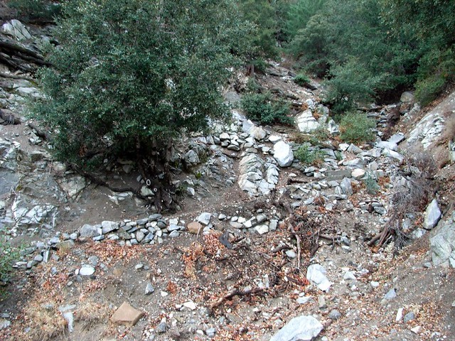
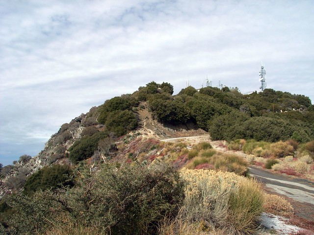
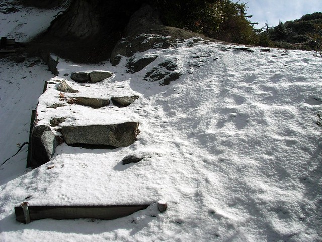
The trailhead looks like a mess, but I promise it’s really easy to find the trail. There’s a paved road that goes to the saddle between Mount Disappointment and San Gabriel that you can also walk up if you prefer asphalt to dirt. But if you do, what are you doing hiking?

Chris and I started up the trail, which meanders along several switchbacks and gains elevation pretty quickly. I’d forgotten how quickly, actually. It can get pretty steep up there. But thankfully, the weather was cool and the trail was almost completely shaded by small trees and brush.

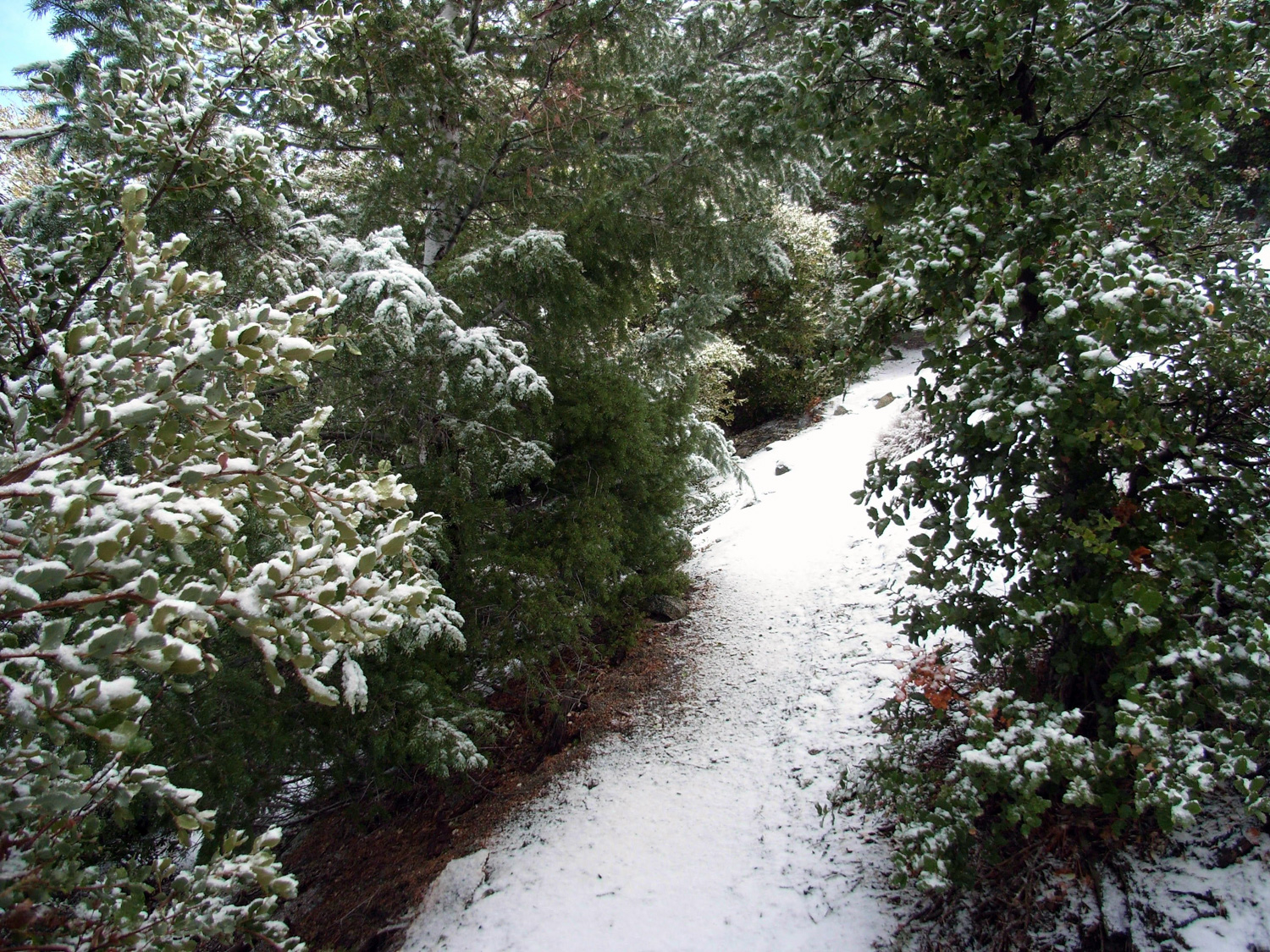
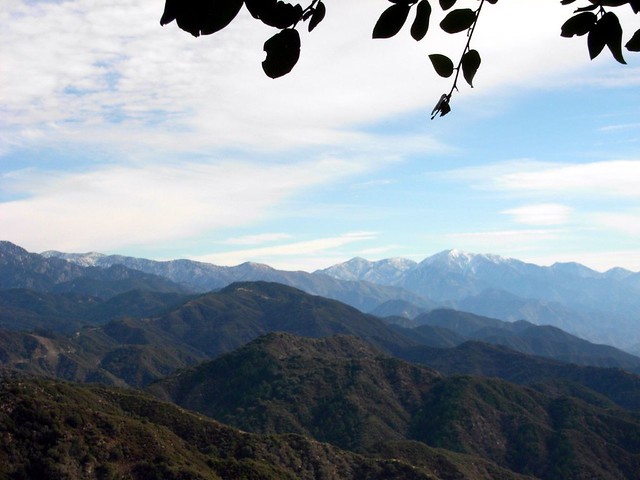
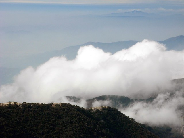
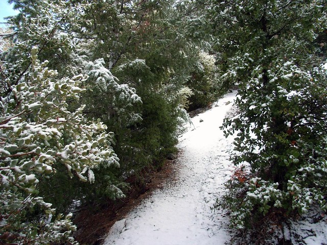
We hiked at a steady pace through the forested sections of the trail, but every time we popped out on the western ridge and faced the snow-capped mountains in the distance, we had to stop and gaze for a few moments.

The San Gabriels are beautiful when they’ve got a little bit of snow on them, and it seemed that most of the peaks above 6000 ft. got a pretty good dusting overnight.

It does, however, mean that a lot of those higher mountains are probably off-limit to me for a little while … or until I buy some crampons.
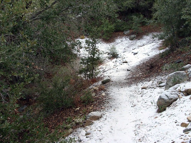
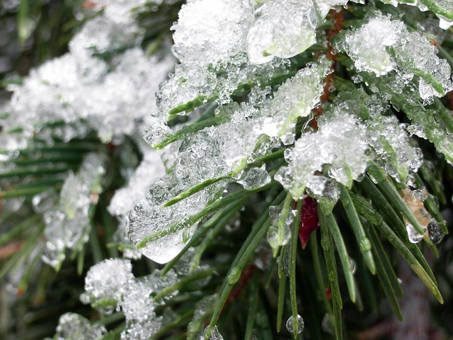
The hike was pretty uneventful on the way up, until we started coming on some trail stones with a light coating of frost. Further up the trail, we had a little taste of full-on snow. Still not enough to get in our way, but enough to make two misplaced New Englanders feel like maybe – for just a minute – that it actually might be winter.

After carefully maneuvering along some of the slicker sections of the trail, we got our first good view of the sharp peak of San Gabriel:

Shortly after, the trail joined up with the paved road, which at this elevation was almost completely covered in ice. We saw the only other hikers of the day, who were trudging on the small dirt shoulder to avoid slipping. We stayed on the ice.

I mentioned we’re both stubborn New Englanders, right?
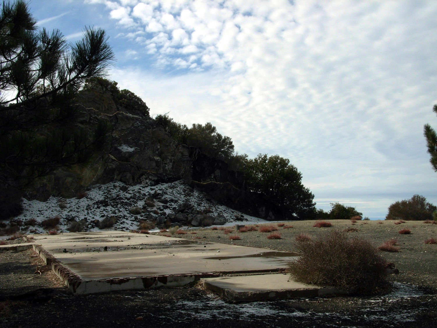
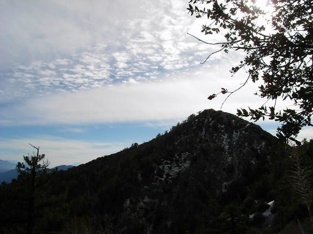
We got to the saddle fairly quickly, and stopped to have a small snack. We had a great view of the levelled top and old military and radio installations of Mount Disappointment.

As we looked into the distance beyond Disappointment, we could see the clouds moving up from the basin floor, cooling and growing as they hit the mountains. The last time I was up here, the city was covered by a thick June marine layer, and as I stood on the ridge, the clouds would swiftly rise through and above me. Today’s effect was a bit slower and more distant, but no less spectacular.

And of course, if we got tired of looking at that, we had Mount Lowe to our south to gawk at.

Or, if you’re Chris, a simple giant pinecone will do the trick, too.

We continued on, dipping down into the true saddle before starting another ascent to San Gabriel Peak. The winds picked up, the snow got thicker, and the air got colder. It was starting to get wintery, and soon we noticed that not only was it winter, but that we were walking on nearly-virgin snow.

With the exception of some small animal footprints, no one had yet walked on this part of the trail since the snow fell.

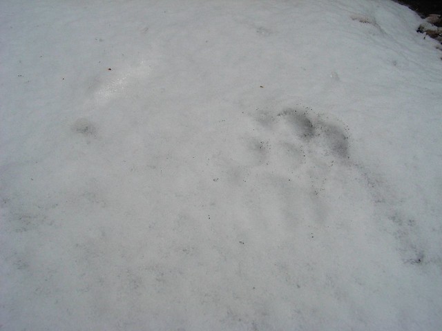
Being the first person on a trail – even if it’s an established trail – can give a slight sense of trailblazing. Knowing that we beat everyone to the forest that morning felt great, and crunching our boots on freshly fallen snow felt even better.

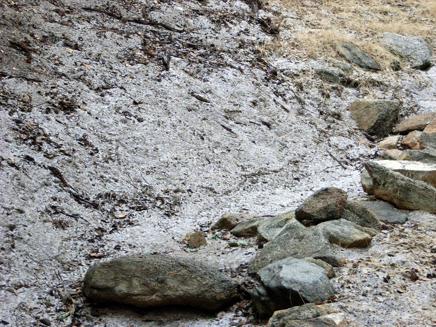
Whatever had beaten us to the trail that morning seemed to like walking on the trail, too. The footprints kept going for a while, and I stooped down to get a better look at the tracks.
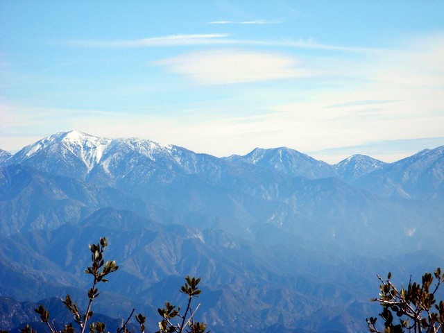
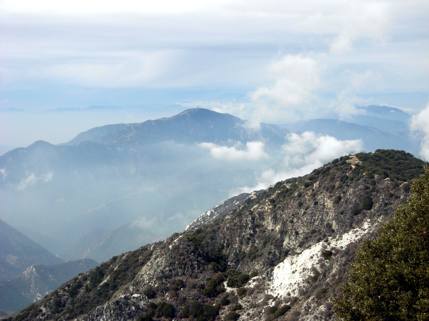
I’m not 100% sure, but they look like bobcat tracks to me. Or a very small mountain lion. The prints were pretty fresh, but whatever it was, it was small. I was, however, privately very relieved when the tracks led off the trail and back down the side of the mountain. It allowed me to focus freely on the nicer parts of the snowed-in trail, like the ice coating the pines, slowly melting around us in the sunlight.

Now we could definitely imagine ourselves back in New England. Except with more mountains. And mountain lions, I guess.

Since the peak of San Gabriel is relatively exposed and doesn’t have too many other peaks blocking its way, you can get a pretty amazing 360 degree view from up there. We had the constantly rising clouds to our west, the cloud-covered cities to our south, and the incredible snowbound peaks to our east.

We sat down on a bench at the peak to relax, take in the views, and eat our lunches. I had my standard Clif / Protein bar combo. Chris brought a much more substantial and delicious lunch, but was thankfully in the sharing mood that day. Raisin pumpernickel bread and jalapeno brie are a lot fancier than a honey peanut Promax bar.

A short break afterward, and we were hiking back down to the car. Another day of hiking done. Nice ‘n’ easy.

Although, I think my feet are itching for some long-distance punishment next week…

http://video.google.com/videoplay?docid=2390363333914561252

The Basics:

- Distance: 3.75 miles
– Elevation Gain: 2023 feet
– Time: Under 2 hours, with a lengthy lunch break.
– Trail Condition: Very good. There are some steep switchbacks near the trailhead, but nothing terrible. The trail up to San Gabriel Peak is a bit more rugged and gets close to some steep edges, but is very manageable.
- How to Get There: Take California 2 East into La Canada Flintridge and the Angeles National Forest. Turn right at Mount Wilson road and continue past the Red Box area. On your first right is a small paved road. Park on the side of the road, or continue up a short distance to a small dirt parking lot. Display your Adventure Pass.

- Map It

The Notables:

- Highest peak in the Front Range (nearby Strawberry Peak, just to the north, beats it by a few feet)
– 49 peaks above 5000 feet are visible from here on a clear day, although the Sierra Club notes the last time that happened was in 1947.
- A short and easy hike with rewarding terrain and views, with access to several additional peaks to extend your outdoors time.

Extending Your Stay:

- You’re practically at Mount Disappointment when you reach the saddle. Check it out for some fenced-off old military buildings, Nike Missile Sites, and radio towers. You could also head south to Mount Lowe and Mount Markham.

More Pictures:

- From this hike.
– From a cloudier hike at the end of July.

{ 2 trackbacks }

Hiking with Kids Near Los Angeles – 4 Questions for modernhiker.com - The Trailmix.Net Blog
March 12, 2008 at 1:13 pm
Hiking Mount Wilson - Devore Trail Camp Loop | Modern Hiker
August 31, 2008 at 2:17 pm

{ 8 comments… read them below or add one }

1 The Vicarious Outdoorsman January 29, 2007 at 9:48 am

Google maps, Google earth, another fantastic write up and NOW a video? It’s too much! TOO MUCH I SAY! My heart can’t take it.

2 WRH January 29, 2007 at 10:53 pm

Well, it’s official then, we need to get some cramp-ons. No more shall snow under foot be a rarley heard sound in So Cal

3 Ranger X January 31, 2007 at 12:26 pm

Very high tech post! Slick. Where do you get the Google hike profile images?

The hike looks like fun, too! That’s definitely a cat print.

4 kristen February 18, 2007 at 1:19 am

I searched google for some write-ups on hiking san gabriel peak and mt disappointment and your blog came up as a hit. This past fall I ascended both peaks. Post trail hike, I felt that the trail I was on was an older unused trail (I saw not a soul). I started up at a point off a road en route to the peak of Mt Wilson where this huge yellow gate is. The trail beyond the gate takes you through Mueller tunnel. Is that where you stopped at? Or did you stop at the parking lot at redbox? Is there any visible markers of the trailhead? None of my friends have actually ascended both the peaks so they weren’t any help in identifying the true trailhead. Any tips would be suggested.

kristen

5 Casey February 18, 2007 at 6:20 am

Kristen,

Mueller tunnel is a bit further down the road from the trailhead I used. I’m guessing you came at the peaks from the south, then? There is a trail that comes up at the peaks from that direction off of Eaton Saddle, which I’ve used to get to Mount Lowe before.

The trailhead on this hike is much closer to Red Box. It’s the very first right past the ranger station, on a semi-paved gated road. The trail is a bit hard to see, but it’s directly across the street from the small parking area. If you’ve got Google Earth (which you should, it’s free and great!), the file above should give you a better visual of where this is.

Let me know if that helps, and feel free to bug me again if it doesn’t!

- Casey

6 kristen February 19, 2007 at 11:20 pm

Casey:

This is so funny and frustrating to me. I took a look at the map and remembered that paved road that goes up to the peak. I had no idea the trailhead was at that road. I passed that area up and drove further up the mountain range to the yellow gate to take the route from the south side. I have had a hard time finding clear instructions and details on finding the trail you took. I will look out for the trailhead, next time I go up, and report back to you.

Thanks for the tip!

Kristen

7 kristen March 25, 2007 at 8:29 am

Casey:

I wanted to let you know that I located the trailhead for the San Gabriel Peak trail. It was hard to locate it at first but once I found the metal bar-thing, with red painted at its tip, I was game.

Thanks for the help.

By the way I hiked Sandstone Peak with one of my friends and we saw, from afar, this giant rock-cliff slab. We observed numerous individuals climbing the face of the cliff. Can you ID this rock climbing location? My friend and I want to check this place out sometime.

http://www.flickr.com/photo_zoom.gne?id=433708207&size=o

Thanks again Casey. I hope your knee recovers well. I can totally empathize with your situation. Last october I fractured my ankle. Not a great three months for me. Take it easy.

Kristen

8 Modern Hiker March 25, 2007 at 8:53 pm

Kristin,

Glad you finally made it up to San Gabriel “the right way.” Hope it was worth the wait!

That rock wall looks like it’s right under Balanced Rock – that giant Looney Tunes-looking boulder that I’m sure you noticed on the way in.

You can get there on an unofficial trail just after the Split Rock picnic area on Mishe Mokwa. I haven’t been down that way myself – not much of a climber just yet – but I’d imagine there are some use trails near the Balanced Rock that should get you to some good climbing areas.

If you need a visual, check out the write-up on this site for Sandstone / Mishe Mokwa / Tri-Peaks. I marked the trail junction with the Balanced Rock Trail.

Let me know how it goes, and thanks for the well-wishes. I think my knee will be ok, but staying in on the weekends is driving me a bit insane…

- Casey

Leave a Comment

Previous post: Hiking Thunder Mountain and Telegraph Peak via Three Tees Trail

Next post: A Tolerable Vegas?