The trek to Echo Mountain is a great hike in the lower San Gabriels to incredible vistas, forested mountain canyons, and the ruins of a turn-of-the-century mountaintop resort. This route also has bonus enjoyment for history buffs, in the form of plaques and markers placed along the ruins and the route of an old railroad through the mountains.
Note: If you just want to hike to the Echo Mountain ruins, the hike will be about 6 miles roundtrip.
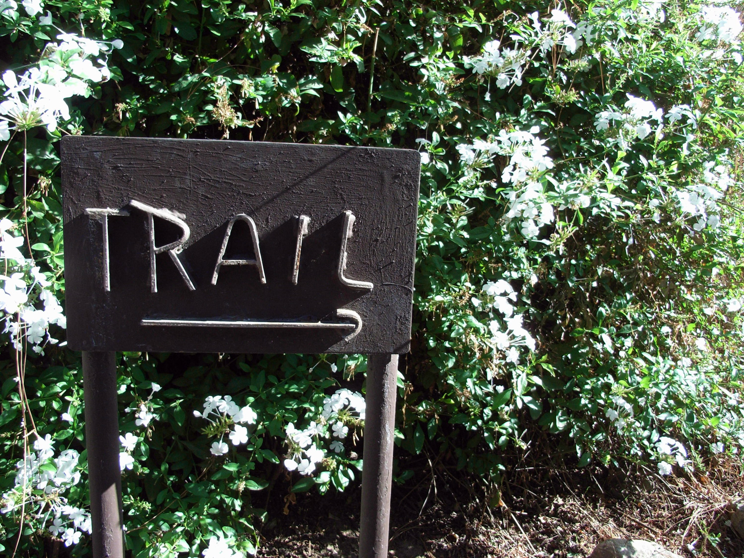
One of the first things you’ll see on the trail is a marker placed by the Altadena Historical Society, marking the entrance to the former Cobb Estate, and the Echo Mountain trailhead. You will see many more plaques along the way. The Historical Society and other groups like the Mount Lowe Preservation Society have really done a fantastic job of researching, maintaining, and marking all of the points of interest along this route — and there are plenty of them.
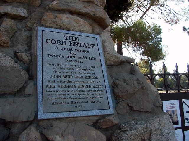
The Cobb Estate belonged to a wealthy lumber magnate, and had several gold mines and water wells on its property before the buildings were completely razed in 1959. One year later, the Marx Brothers bought the land and wanted to turn the area into a cemetery. Luckily, students from the aptly named John Muir High School bought the land and donated it to the Forest Service. Now the land houses several miles of equestrian trails, a small botanical garden, and the entrance to the Echo Mountain Trail.

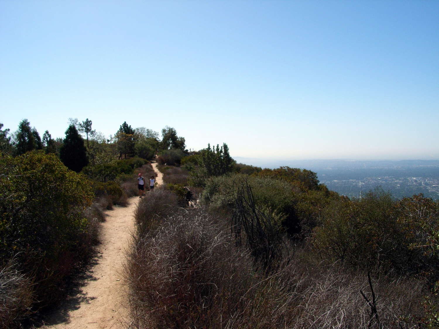
The trail crosses a flood control area and begins zigzagging its way up the southwest base of Echo Mountain. This section of the trail is very heavily-traveled, but is in excellent shape – especially for such a popular trail. The path is very well maintained, and I only noticed a few minor examples of trail trash on the way up. The grade is nice and easy, too — it’s about 3 miles from the bottom of the mountain to the resort ruins, at just over 1400 feet of incline. There’s a lot of switchbacks, yes, but you’ll feel like you’re making enough progress where it won’t bother you.
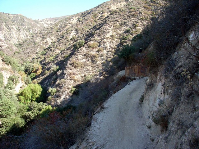
The trail does get more rugged the further along you hike, but nothing’s too bad on this stretch. If you’re hiking in the morning, you’ll get plenty of shade while climbing the west side of the ridge — otherwise, you’re not getting much of any shade. The first time I hiked this was in the middle of May in jeans and a long sleeve shirt. Needless to say, I lost a lot of water weight that day. But be sure to enjoy the views as your rise above the cities and into the mountains!
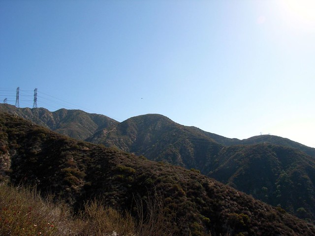
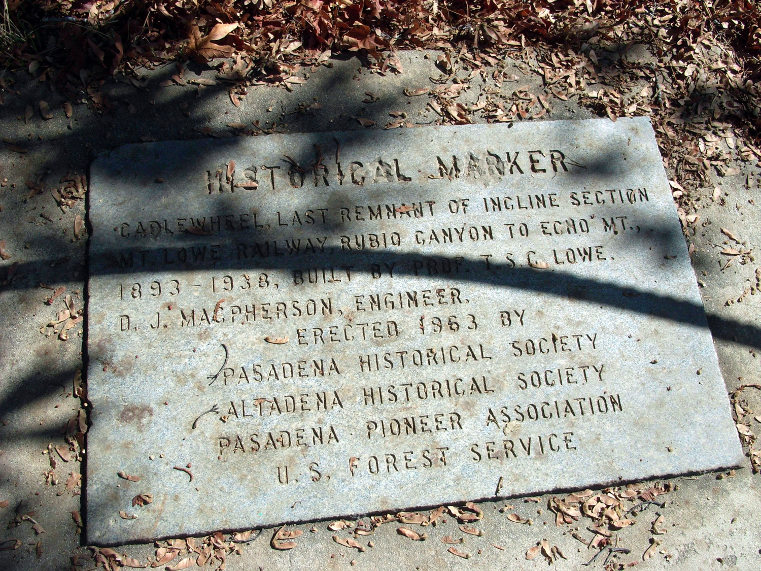
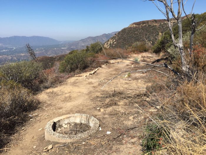
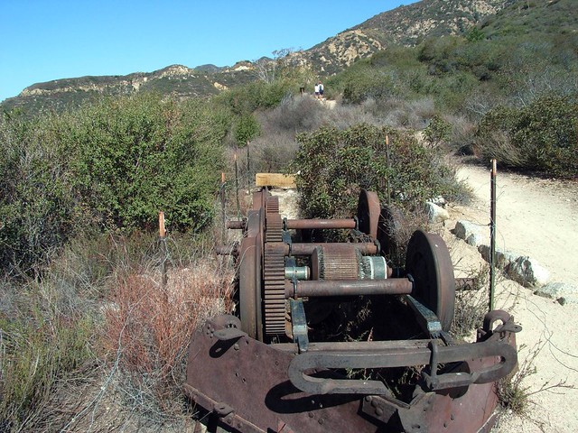
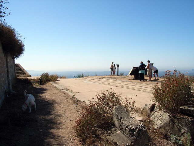
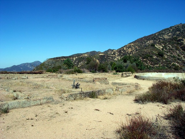
At around the 3 mile mark, you’ll reach a plateau and come upon a silver plaque from the National Register of Historic Places — which is always a way to catch my eye, if you’re ever wondering. It marks the section of the trail where you’ll meet up with the old grade for the Mount Lowe Railroad – a twisted series of cliff-side rails that used to bring paying customers to the Echo Mountain Resort from a nearby stop-off point.

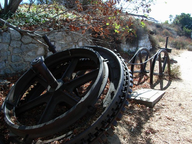
Today, all that’s left are a few sections of iron track, the grade, and some abandoned gears near the old hotel…
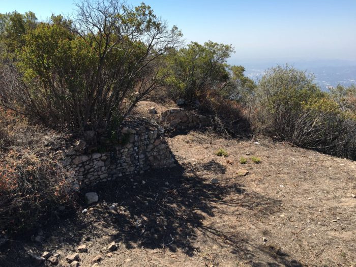
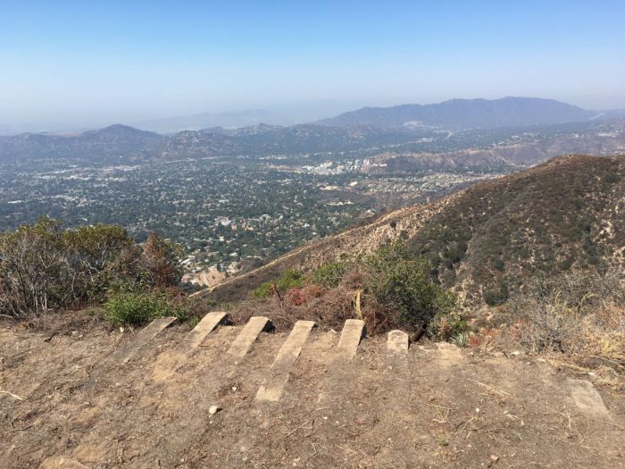
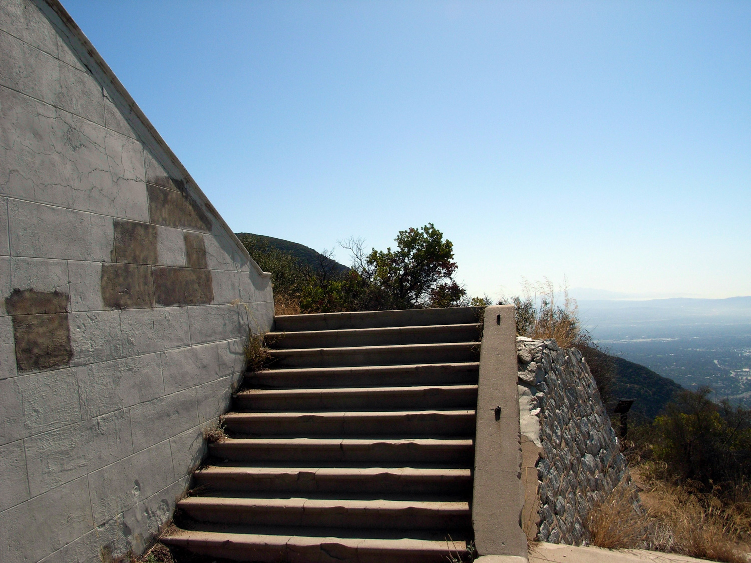
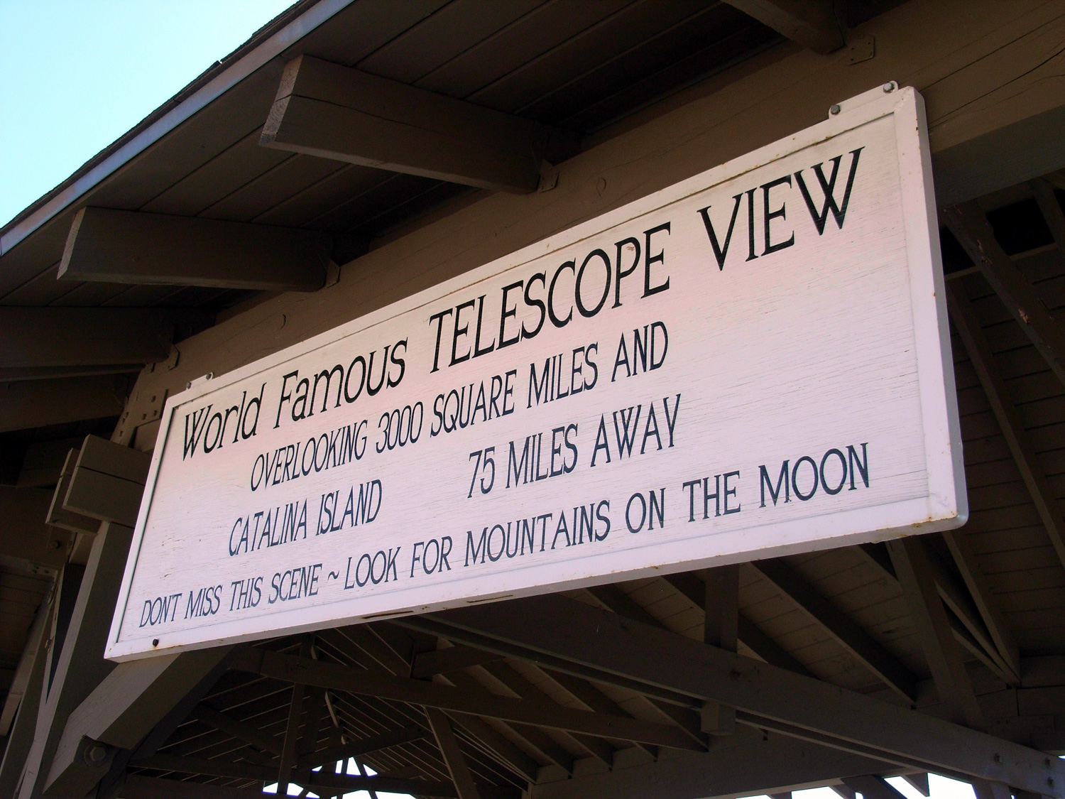
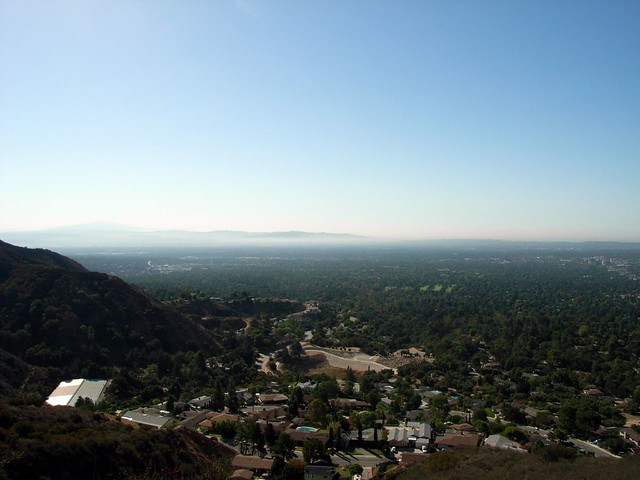
The hotel itself is almost entirely gone, but a series of plaques and laminated photos around the site does an excellent job of recreating the splendor of the place in its heyday. At the main foundation of the Echo Mountain House, you can still easily make out the different rooms on the floor plan — and you can also see Inspiration Point in the distant mountains (in the saddle on the left). But you’ll probably have more fun imagining yourself at the same site at the turn of the century, comparing the old pictures with what’s left over.
By the time he retired to Pasadena in 1888, Professor Thaddeus S. C. Lowe had already checked quite a few items off of his bucket list. The mostly self-taught New Hampshirite was famous for his early meteorological theories and exciting ballooning adventures as well as his exploits as the U.S. Army’s first Chief Aeronaut of the Union Army Balloon Corps. Lowe built a fortune from his inventions and patents on ice making machines and hydrogen gas manufacturing. Even after he retired, Lowe built a gas works, ice-making company, and founded two banks … and that still wasn’t enough.
After meeting the engineer David Joseph Macpherson, the two conspired to build railways into the San Gabriels. A toll road to Mount Wilson nixed their first plan, but in 1892 the pair began construction on the world’s first electric-powered incline railway from Rubio Canyon to the summit of Echo Mountain. A hotel and pavilion were built first at the bottom of Rubio Canyon in 1893, quickly followed by the Chalet and Echo Mountain House atop Echo Mountain itself by 1894. Not satisfied, Lowe also built a small zoo, an observatory, and installed the world’s largest searchlight atop what came to be known as The White City. More than 30 miles of trails were constructed, along with an extended railway with 127 curves and 18 bridges from the Echo Mountain House to another hotel called Ye Alpine Tavern, completed in 1895. Unfortunately, fire and windstorms destroyed the Echo Mountain House and Chalet by 1905 and Lowe lost ownership of his railway to the Pacific Electric system. That sale provided the railway with the cash for numerous improvements and reconstructions as well as a connection to L.A.’s famous Red Cars—indeed, you can still find locals who remember riding the train from Long Beach all the way to Ye Alpine Tavern.
More than 3 million people rode the trains to these alpine hotels until the Tavern burned in 1936. The last train ran in 1937 and by 1939 the system was being dismantled. By the early 1960s, the Forest Service had destroyed what remained of the Tavern and the powerhouse on Echo Mountain—but the ruins, stories, and photographs of Echo Mountain continue to inspire dreamers today.
For more info and excellent historical photographs, be sure to visit the Mount Lowe Preservation Society at www.mountlowe.org.


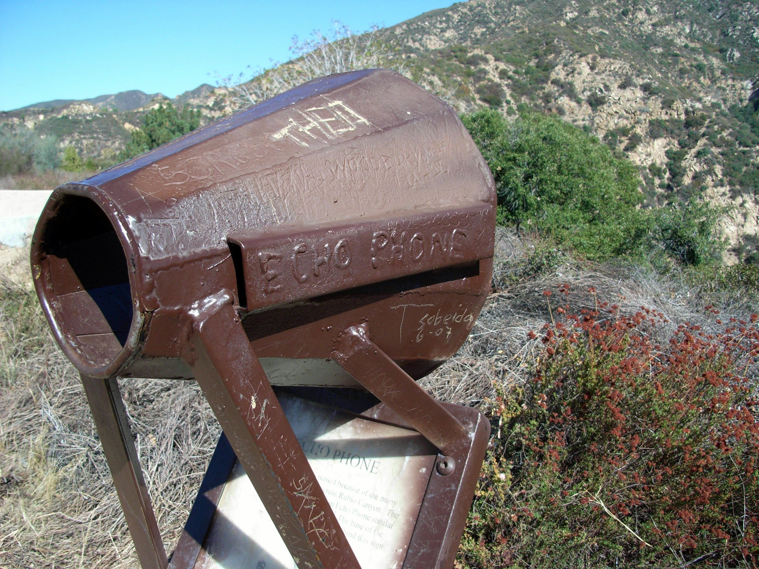
If you want to make some noise, you can even walk around to an old ‘Echo Phone’ — basically just a ground-mounted megaphone that you can shout through to hear an echo. There was another one installed up at Inspiration Point, so patrons could yell to each other. The local wildlife must have loved it.
When you’re done learning and exploring, head back the way you came and hang a right onto the Castle Canyon Trail. This is a thin, rugged, fairly secluded stretch of trail that will take you far from the (relative) crowds at the old ‘white city’ ruins and deep past Rubio Canyon into the narrow, steep Castle Canyon.
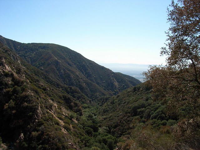
There are a few stretches along this trail that I remembered as being fairly harrowing when I first started hiking, but this time along I didn’t even notice them. Once the path gets into Castle Canyon, though, it doesn’t take much time climbing up and out of it. It’s a steep, switchbacked, leg-burner. But the great thing about it is that you can’t really see the Inspiration Point pavilion until you’re almost there. So when you’ve just about lost your motivation, you get it all back again in one nice visual.
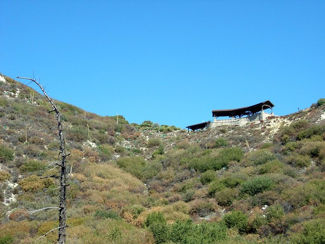
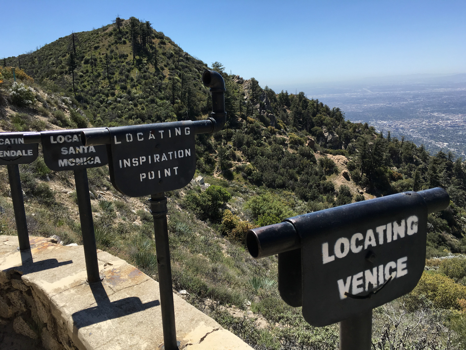
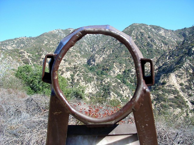
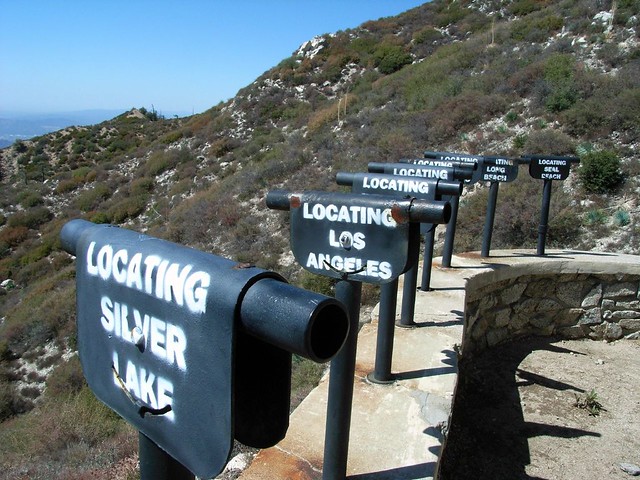
At Inspiration Point, you can get even more of your history on with a few more plaques, and take a look through some restored “finding tubes,” which show viewers a certain location on the horizon — if you can cut through the haze.

From here, you can explore the site of old-time Sunday services, or keep traveling up another old railroad grade to the site of the Ye Alpine Tavern wilderness hotel at the Mount Lowe campground, and continue on to Mount Lowe — or you can take the Sam Merrill trail back down to the Echo Mountain ruins.
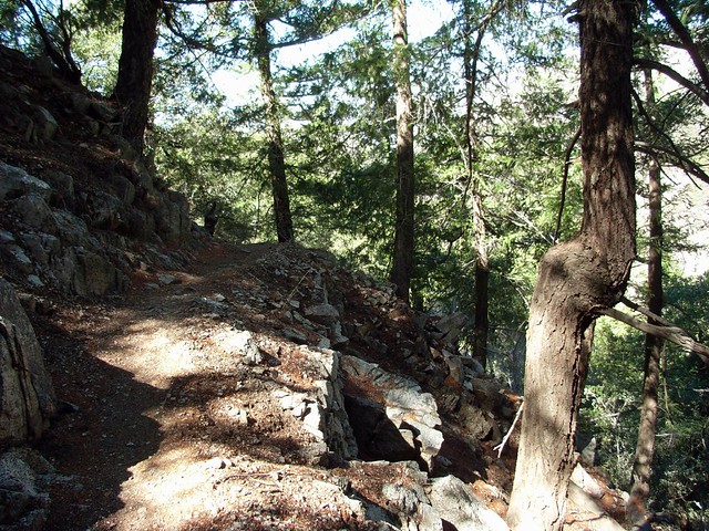
The Sam Merrill Trail is another treat to travel down — the first section is entirely on the north side of the mountain. The trail is cool, rugged, and well-shaded — which will surely be a welcome environment after trudging up the Castle Canyon Trail.
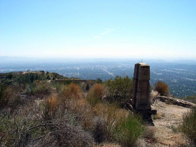
On the south side of the mountain, though, the trail returns to shadeless chaparral, and has a few sections with deep gouges — both from water erosion and mountain bikes. Just north of the Echo Mountain hotel, you can also stop off at the ruins of an old observatory, and gaze down on the L.A. that is while sitting near the L.A. that was.
Tags: altadena, Angeles National Forest, echo mountain, Hiking, inspiration point, Los Angeles, Mount Lowe, mount lowe trail, Trail Write-Ups, transit accessible, white city