Hiking Fryman Canyon

by Modern Hiker on February 9, 2009

null
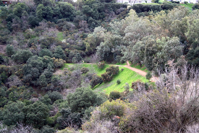
A short, 3 mile loop in the Hollywood Hills. Centrally located, with easy access from Hollywood and Studio City, this is a slightly easier but MUCH nicer alternative to other popular Hollywood hikes like Runyon Canyon. Fryman Canyon has fire road or trail paths, plenty of spur trails to vista points and benches, and access to the Tree Peoples’ Coldwater Canyon pavilion. While it is an urban trail, it doesn’t seem crowded on the trail. And while it’s dog friendly, it doesn’t have the pile-of-poop problem that Runyon has.

null null null

The Basics:

- Distance: Just under 3 miles round trip.
- Elevation Gain: 463 feet
- Time: An easy 90 minutes.
- Trail Condition: Excellent. Well-maintained fire road for the majority of the trail, with clear signs and landmarks. The use-trails that parallel the fire road are not marked or maintained, but are heavily traveled and easy to spot.

- How To get There: From the Valley, head south on Laurel Canyon Blvd. from Studio City. 0.8 miles south of Ventura Blvd., turn right onto Fryman Road. The parking area is immediately visible. From the south, at Laurel Canyon (Crescent Heights) and Sunset in West Hollywood, head north on Laurel Canyon for 3.5 miles. Take a left onto Fryman Road and park in the lot. There is a $1 fee for parking.

- Map It

The Notables:

- Easy access from West L.A. and the Studio City area
- Easy, mostly-shaded trail that’s dog-friendly
- Popular, but not overrun with people like nearby Runyon Canyon
- Opportunities for side-trail hiking throughout the park

More Pictures:

- on Flickr

elevation profile of fryman canyon

google earth profile of fryman canyon

My friend Blair had been trying to get me out to Fryman Canyon for a while, singing its praises as being “Just Like Runyon, Without The Runyon.” So, on a long weekend, I finally took her up on the offer and trekked all the way out to the strange and distant land known as Studio City.

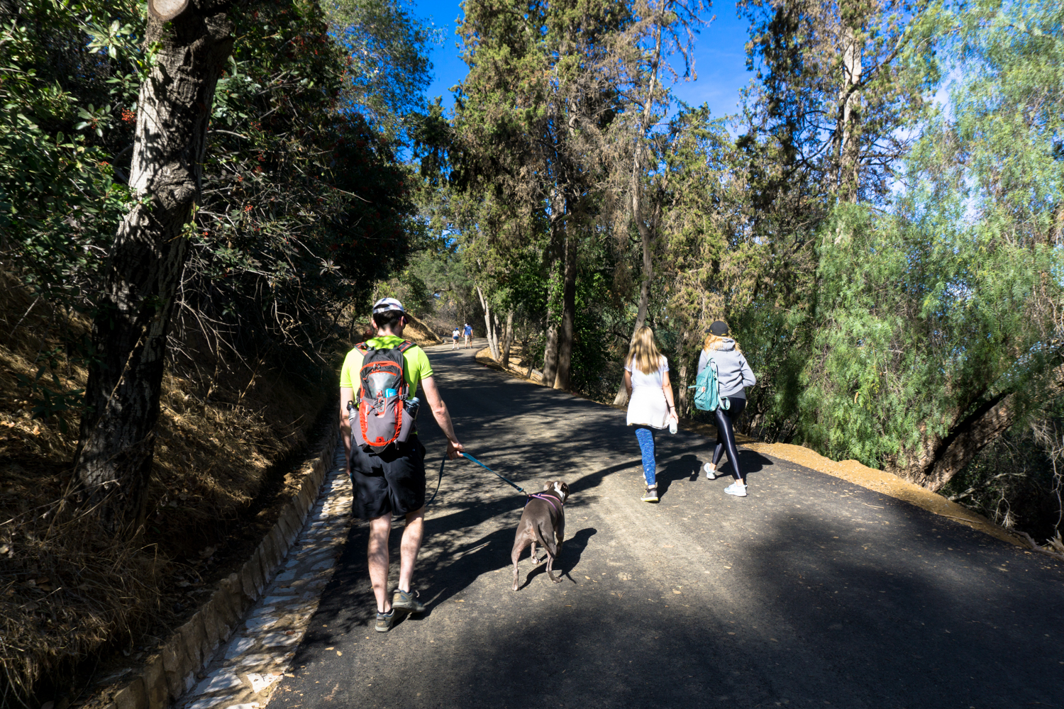
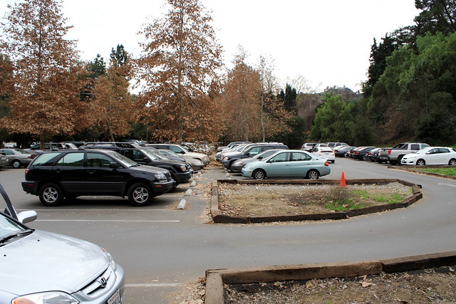
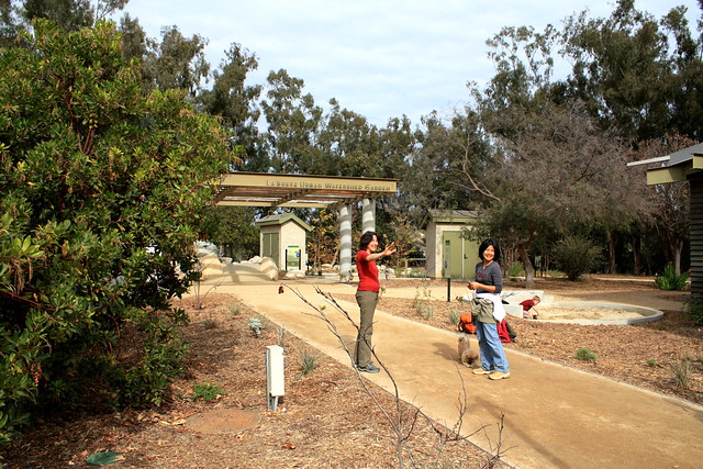
Yes, just a quick drive over the Hollywood Hills and we were at the trailhead just off Laurel Canyon Blvd. – a small and packed-to-the-brim parking lot, full of hikers, joggers, and dogs.

IMG_0291

While we did have to wait a few minutes for parking, I was assured that the turnover for the lot isn’t that bad, and you can usually find a spot within a short wait, even if the lot’s full. There is a $1 parking fee for using this area, and we walked back to the gate to feed the meter and place the printed permit on the windshield. After you’re all official, head toward the parking lot entrance and cross the gate onto the paved road.

IMG_0294

While this is commonly known as Fryman Canyon, the park is labeled “Wilacre Park” on other maps, and the trail sign declares it the “Betty B. Dearing Mountain Trail.” Whatever you want to call this area, the hike on the paved portion of this trail only last for about 0.3 miles, giving way to a dirt road. But even the paved portion is a nice walk — well shaded and occasionally offering some nice views of the Valley cities.

IMG_0295

IMG_0296

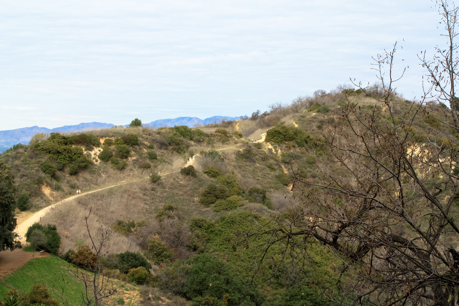
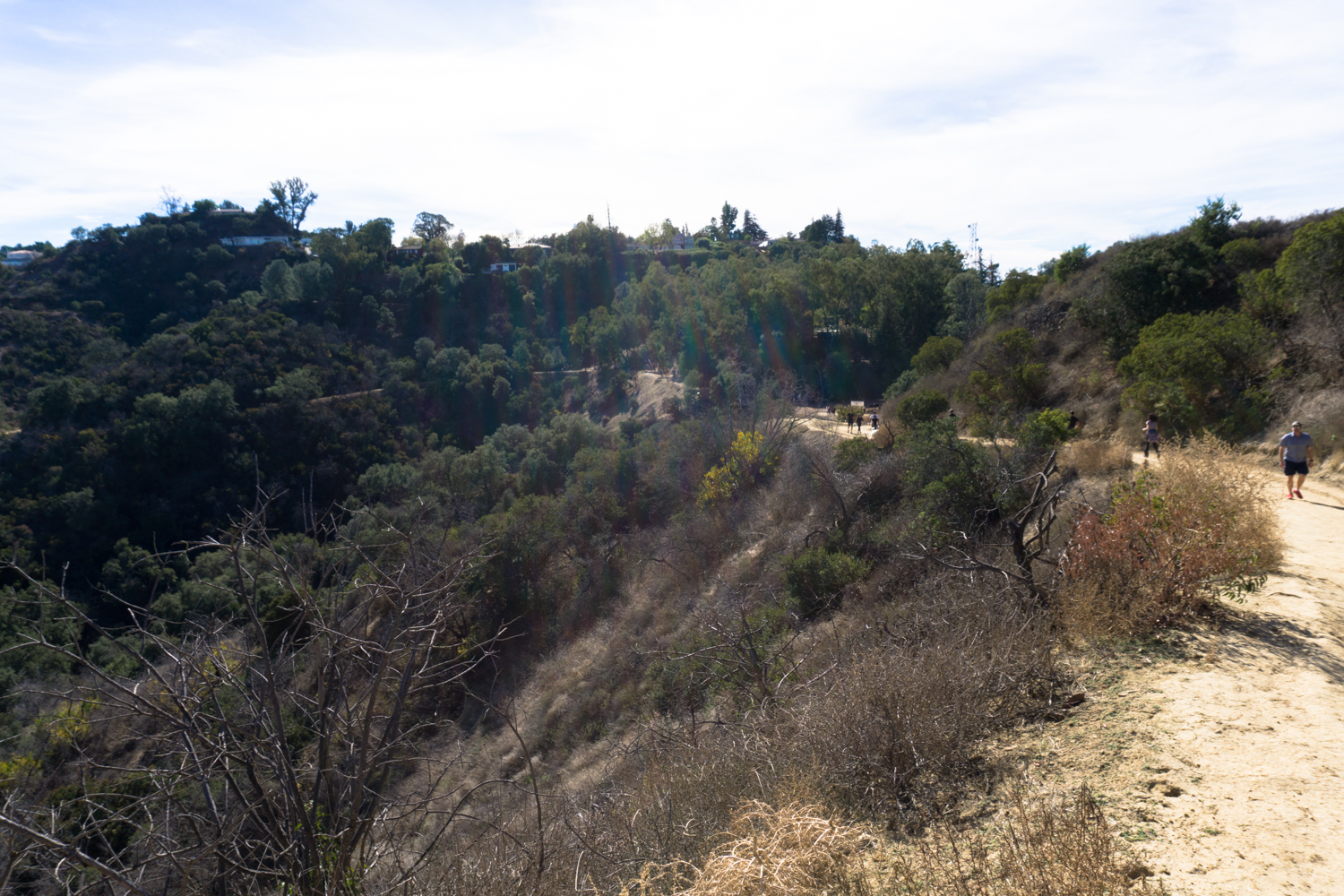
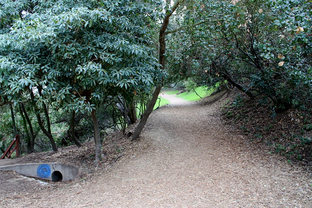
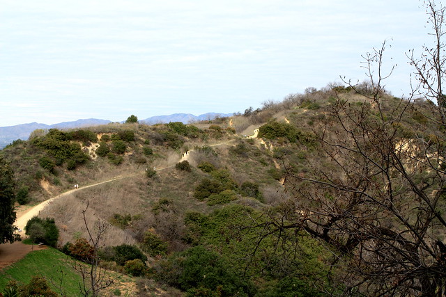
While this is not a difficult stretch of trail by any means, there is a gradual but noticeable elevation gain. In the first half mile, you’ll gain about 270 feet — after that, the trail hits a sort of straightaway, slowly trudging up an easy gain. You will also begin to notice a few side-trails climbing sharply to the south, away from the fire road. While these trails are not marked on any maps of the park, they lead to a rough system of use-trails that generally parallel the fire road. So if the crowds are getting to you, you can take a quick escape along one of these many optional routes.

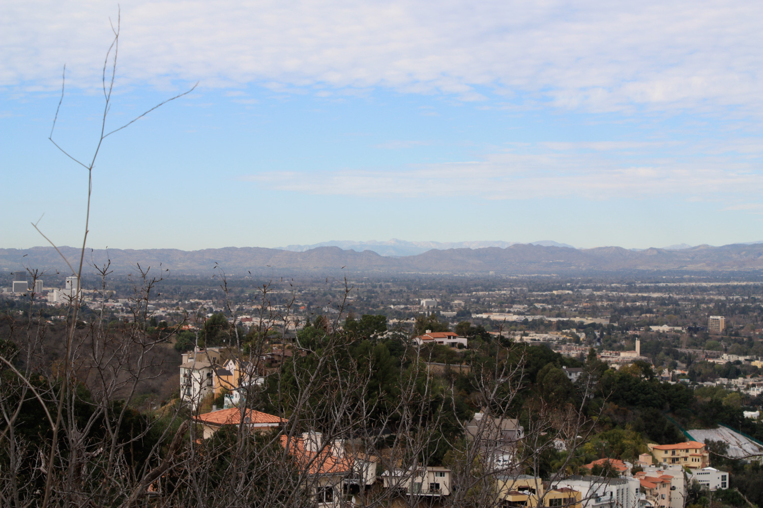
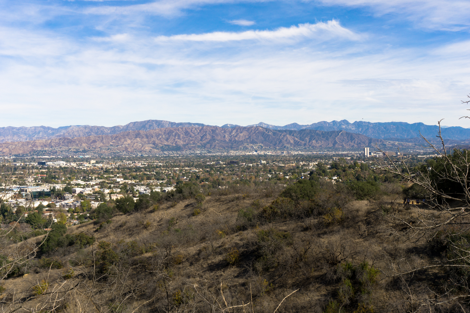
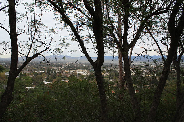
At 0.6 miles, you’ll pass the first of several memorial benches, placed in scenic areas and shady spots along the trail. If you keep moving, the trail continues to the southwest, then loops around a ridge and turning toward Coldwater Canyon Park. At the 1.3 mile mark, you’ll get a nice view of the the end of the canyon, and the side trails up into Coldwater.

IMG_0301

Continue just a few hundred feet more to the junction with Coldwater Canyon Park. This is the very north end of the sprawling park unit, which stretches through Franklin Canyon all the way to Beverly Drive in Beverly Hills. It is also the home base of the tree-planting volunteer group TreePeople. At about 1.4 miles, you’ll reach a junction where the main road descends into the canyon, and a side trail rises up out of it. Take the side trail.

IMG_0304

You’ll climb a small incline and pass a built-in exhibit about the various types of rocks that make up the Santa Monica Mountains. Get your learn on, or keep walking.

IMG_0305

At about 1.5 miles, you will come to another trail that continues climbing up the ridge.

IMG_0307

But before you continue, you can also take a few minutes off and explore the TreePeople’s new Center for Community Forestry, which will be right behind you. There’s a tree nursery, an interesting urban runoff garden, some great landscaping, and an amphitheater which hosts occasional educational programs for students and the public.

IMG_0308

When you’re done poking around, head back up that trail, near the rock-exhibit stairs. This leads to a side trail that parallels the main fire road, but – from what I’m told – is usually pretty devoid of hikers. It will also give you some nice vantage points on the rest of the canyon, including some views of the trails you’ve already hiked to get here.

IMG_0310

Continue on this trail until about the 1.7 mile mark, where you’ll come upon a secluded picnic area and a bench looking toward the San Gabriel Mountains to the east. If you’re lucky and hike this on a clear day, you may even be able to make out some distant snow-caps (I was barely able to spot a few, myself). But more often than not, you’ll probably just get Universal City, Cahuenga Peak, and Griffith Park.

IMG_0313

This is the end of the trail, or so it would seem. If you don’t feel like backtracking on the fire road (and maybe have been itching for a more challenging trail), instead continue walking just past the benches. You’ll see a faint but clear path emerge between the brush, which eventually becomes a very steep use-trail back down to the fire road.

IMG_0315

It’s a very short trail, but it’s overgrown, rocky, and the final section is very, very steep. It’s not really anything like what’s on the rest of the fire road, so if you’re not used to that sort of hiking, I’d recommend just doubling back and rejoining the fire road near the Coldwater Canyon marker.

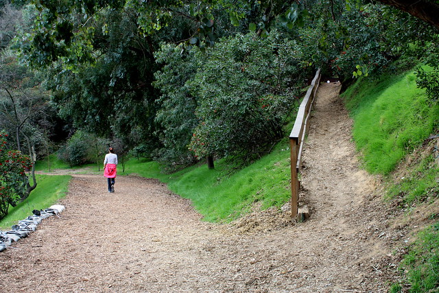
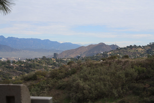
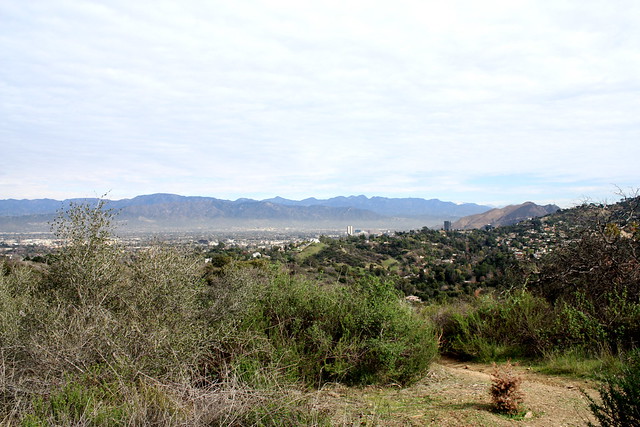
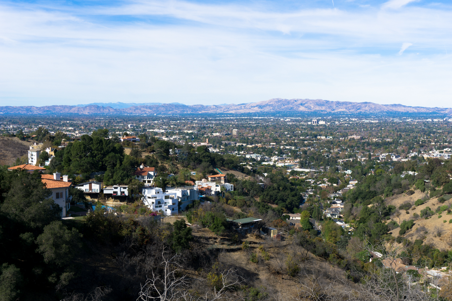
Once you hit the dirt road again, continue heading east. Here, the trail begins to press up against the private landowners in the hills, and the north side of the trail gets fenced off. It’s not the most pleasant thing to look at, but the overall trail condition is still fairly nice.

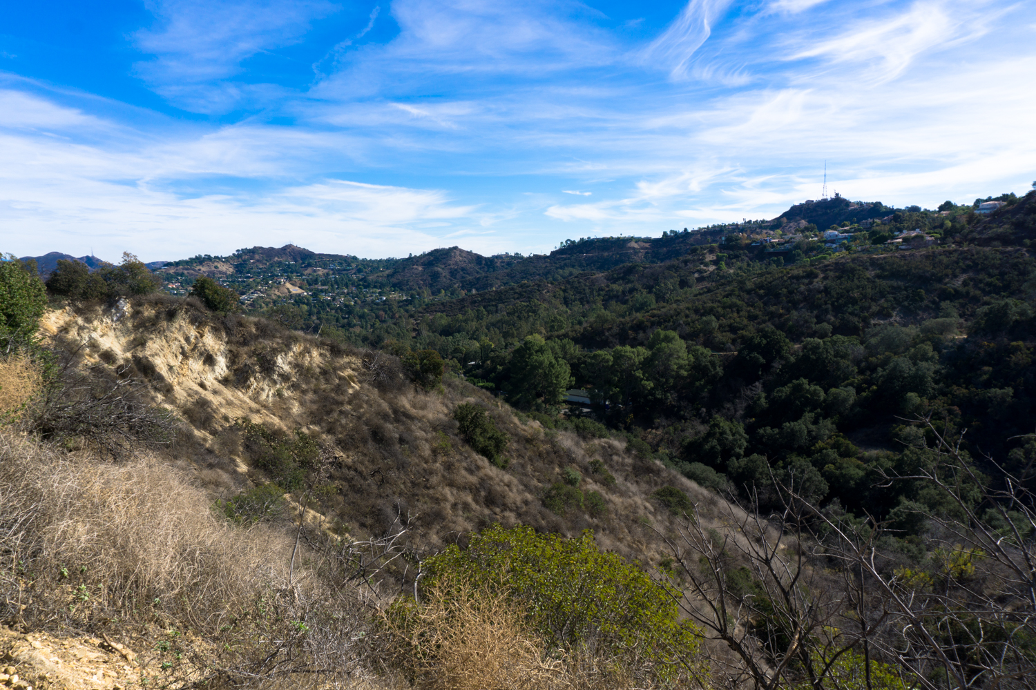
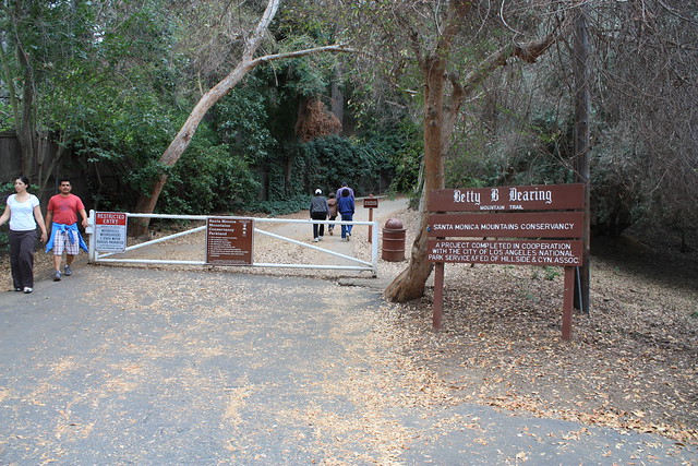
At 2.1 miles, the trail spills out onto a cul-de-sac at the end of Iredell Lane. A few hundred feet down the road, on the south side of the street, there is a fire road that climbs back up the ridge from the street. This is the entrance to the “Rainforest Trail,” a winding single-track trail that meanders through some of the non-developed areas in the Hollywood Hills. I didn’t know much about it when we were there, otherwise I would have explored more — but the LAist checked out some of the scenery a few years back.

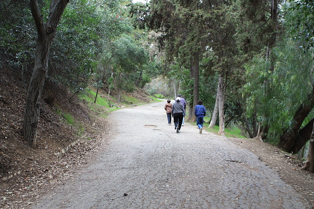
Unless you choose to explore the Rainforest Trail, continue on the road for another 0.2 miles, taking a right at Iredell Street and then a left onto Fryman Road to return to the parking area. Even though this is a residential area, it’s still a pleasant downhill stroll. And most likely, you’ll still be surrounded by hikers from the canyon. Even the Google Street View Van couldn’t escape ‘em.

Hollywood Hotels

{ 11 comments… read them below or add one }

1 LH May 24, 2009 at 6:05 pm

parking is now $3.00

2 sasidhar79 May 27, 2009 at 3:41 pm

Hi,

I have been enjoying your posts about the hikes in Southern California.

I am planning to hike Half Dome – Yosemite National Park this August, therefore I am looking for trail that I can hike every week as a conditioning hike.

please let me know if you know any.

thank you

regards
sasi

3 Breck June 12, 2009 at 4:00 am

Decent little hike. Parking is now $3.

4 judy February 16, 2010 at 3:51 pm

Do you know if you can bring baby strollers on this hike?

5 Marisa Gonzalez March 5, 2010 at 7:55 pm

Can you help me? I’m looking for a hiking trail that is south of Ventura Blvd. I thought it was Encino off of Hayvenhurst. it is not the one off Reseda. The drive goes through houses and then ends up a dirt road with a gravel parking lot. I know I’m not crazy. Can’t find it anywhere on the internet. Help!!

6 Mommyof3 April 14, 2010 at 7:26 pm

For Judy, wasn’t sure if you checked out fryman yet….But yes, strollers are used often…..I’d recommend a sturdy jogger like a b.o.b. I go there regurlary and spot many mom’s and dads with singles and doubles….I gotta a single and it is a good workout going up with that extra resistance…

7 Steve April 18, 2010 at 4:42 pm

This region of Fryman Canyon that we called the Rain Forest, we being us hippie kids that grew up in LA in the ’60′s and ’70′s, was the place we’d go to enjoy a night of psychedelics, especially in the full moon light (actually, almost every weekend). What a breathtaking sight to watch searchlights (from the ground, not police helicopters) trailing through night skies over the snaking freeways of the Valley. By dawn, we would have followed the fire road to the top, where it appears someone has built a rich, garrish house. But the tree-swing seems to be still swinging!
I don’t live in LA anymore (I could never move back…ugh), but I plan to visit soon. I hope that what has been built up for ‘regular folk’ hasn’t erased what made this special place so special. It was probably better when it was kept secret. At least I have my memories.

8 Dan June 11, 2010 at 4:34 pm

Why don’t they have the other trail mapped out? There’s another path that is much harder than the normal path. It starts up at the dead-end on Iredell Ln where you normally come out. Where the road curves there’s a path that forks off the street headed southeast. On the path is a trapeze swing, a small creek and at the end is Mulholland, right at an overlook point. I would like to see this trail mapped out cause I know there is a few forks along the way.

9 ro June 13, 2010 at 6:21 am

Is it safe to hike fryman canyon alone?

10 Elizabeth June 22, 2010 at 9:12 pm

What trail was always shown on the TBS show Men of a Certain Age?

11 Dano July 2, 2010 at 2:10 pm

Thanks for the awesome info. I forgot how much parking was and one of your astute commentators helped out!
Dano

Leave a Comment

{ 3 trackbacks }

Previous post:

Next post: