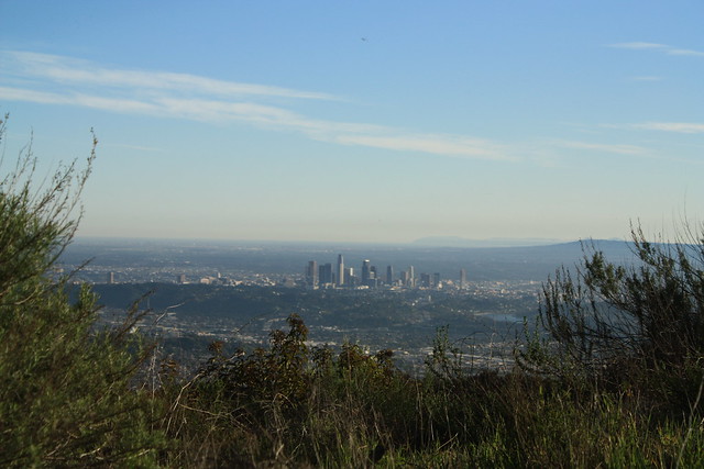
Hiking Verdugo Mountains

by Modern Hiker on March 24, 2009

nullA just-under-six mile loop on fire roads in the mountains between Glendale and Burbank. A moderate hike that can be easily overlooked, this loop is a great last-minute hiking getaway that has outstanding views of the city when the air is clear, and decent wildflower shows during the spring months. This trail should be avoided on hot summer days, as there’s very little shade … but if you hike later in the afternoon, the mountain will cast its own shadow on large portions of the route.

null null null

The Basics:

- Distance: 5.83 miles
- Elevation Gain: 1368 feet
- Time: About 2 and a half hours
- Trail Condition: Excellent. Well-maintained fire road, with clear signs and landmarks.
- How To get There: From the South, take the CA-2 or Glendale Blvd. north into Glendale. If you’re taking the 2, exit at Mountain Street and turn left. In 0.5 miles, turn right onto Verdugo Road, which becomes Canada Blvd. In 1.8 miles, take a left at the light onto Country Club Drive, and follow this road for 0.4 miles before taking a left onto Beaudry Blvd. Drive another 0.4 miles to where the road makes a sharp right hand turn on a steep incline. This is the trailhead. Park on the street – no permits required.

From the North – from the 210, take exit 17 for La Crescenta Ave and travel south. Continue on La Crescenta for 1 mile, then turn right onto Oakmont View Drive. In 0.6 miles, turn left at Barnes Circle. In 0.3 miles, turn right onto Beaudry Terrace and park in 0.1 miles.

- Map It

The Notables:

- Quick, easy hike close to the city
- Nice views of the San Gabriels and the L.A. basin
- Fire Road trail

More Pictures:

- on Flickr

elevation profile of Verdugo Mountains

google earth profile of rocky peak

On a late Sunday morning, I wasn’t planning on hiking, but some great weather and the frightening prospect of spending the rest of the day inside doing laundry fired up my trustworthy hiking urges again, and I searched for a trail to stomp. After looking around, I found someplace close, with good views, and a moderate incline — the Verdugo Mountains.

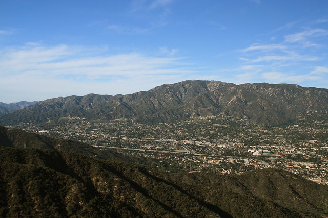
The Verdugos are a small off-shoot range that run roughly between the San Gabriels and the east end of the Hollywood Hills, between Glendale and Burbank. They’re not wild or secluded by any stretch of the means, but their prominence in the valley make up for their lack of elevation, and they’ve got amazing views on clear days.
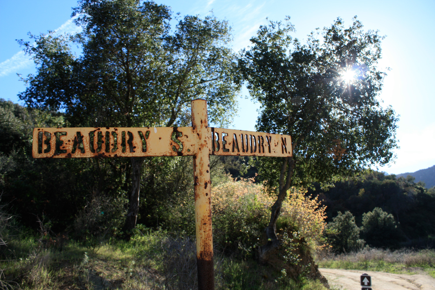
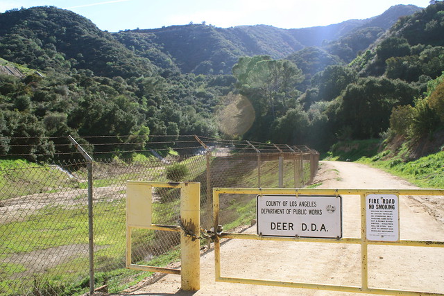
The trailhead for this loop begins at the end of Beaudry Blvd. in Glendale, near a flood control dam and spillway.

IMG_0538

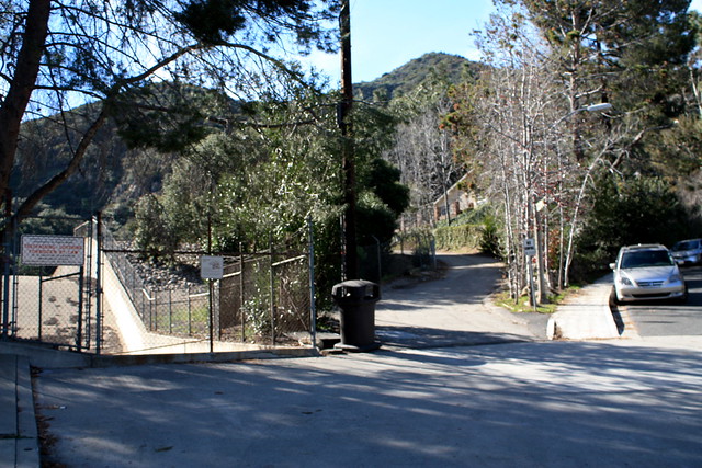
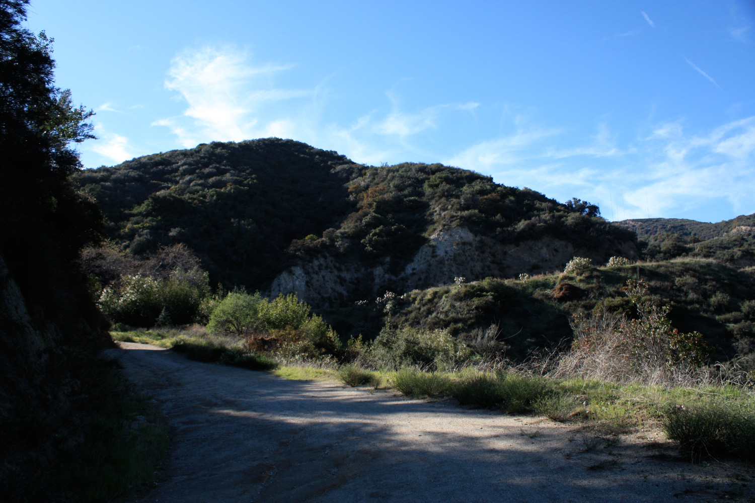
There is a very short paved road that follows the north side of the flood control area. This pavement ends about 370 feet later at a locked gate. Pass by the lock and continue on the dirt road, knowing the scenery does in fact get nicer than barbed wire fences and residential backyards.

IMG_0541

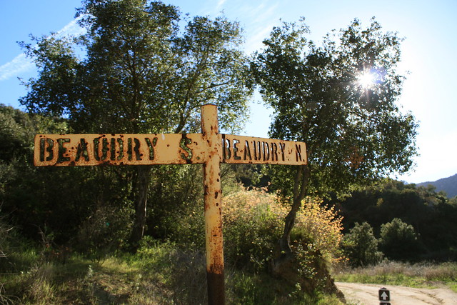
There is almost no elevation gain for the first half mile, while the fire road gently winds its way around the drainage basin and up to a well-marked junction between the Beaudry North and South Motorways. It’s very tough to miss:

IMG_0546

While it doesn’t necessarily matter which direction you do this loop hike in, I took the north road first. As I was hiking in the mid-late afternoon, the north road generally had more shade than the southern, so if it’s a hot day out you’ll want to take the north route first. But really, it’s up to you.

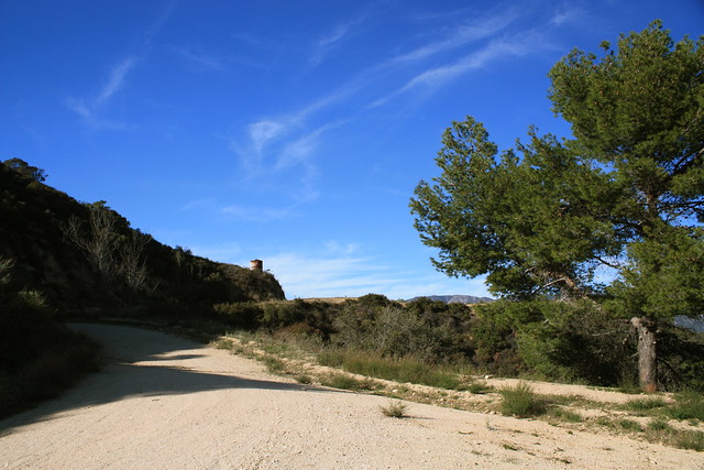
The fire road meanders along ridges as it makes its way west and then northwest, gradually opening some nice views of the San Gabriels to the northeast. This perspective really puts the urban civilization in contrast with its rugged surroundings, as well as gives you a whole new appreciation for the earthquake geology that shaped it all.

IMG_0551

IMG_0552

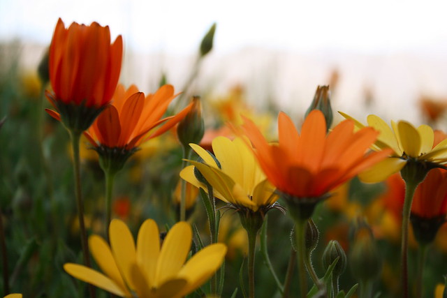
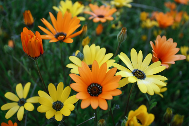
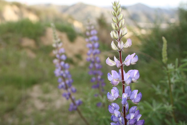
On this north-facing side of the mountains, I came upon a small but vibrant patch of gazanias, blooming wildly. No, they’re not native and yes, they probably tracked themselves up here on someone’s shoe, but that doesn’t mean they’re not nice to look at.

IMG_0559

IMG_0555

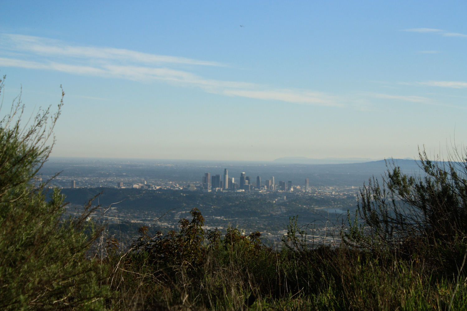
At about 2.6 miles, the fire road intersects with the South branch of the Beaudry Motorway. Hang a sharp left here onto the South Road, where you’ll get your first glimpses of Burbank and – if you’re lucky – the cityscape all the way to Palos Verdes and Catalina Island.

IMG_0560

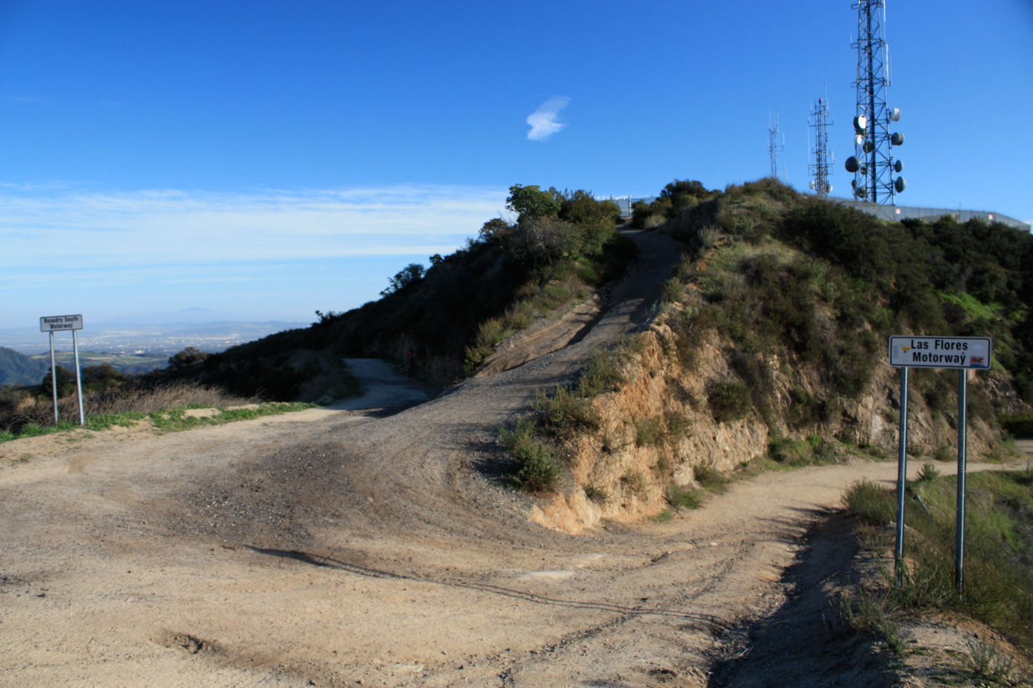
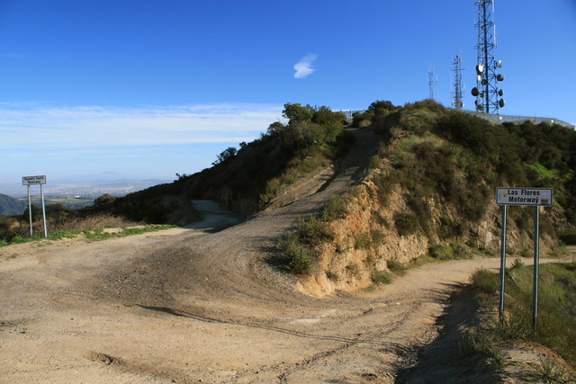
Continue on the South Road, and at the 2.9 mile mark, pass by a locked, fenced and gated radio tower complex. This is the highest point on this loop, at about 2600 feet. Sadly, there’s not a whole lot to see from this vantage point, so continue along the road to the 3.6 mile mark. Here, the Beaudry Motorway intersects with the Rimcrest-Las Flores Motorway, another system of fire roads that winds along the mountains’ south face. Stay left at the intersection to stay on the South Beaudry road.

IMG_0567

Stay on this road for another 1.8 miles, as it occasionally offers some very nice views of the downtown core and some lupines if you’re hiking in the spring.

IMG_0568

IMG_0569

From there, it’s another 0.4 miles back down to the trailhead.

Glendale Hotels

{ 15 comments… read them below or add one }

1 Will aka "walka walka" March 24, 2009 at 11:57 pm

Even fire roads look appealing to my sorry land locked ass. And yes I am drunk reading modern hiker to make me feel better.

2 Hiker Dude March 25, 2009 at 7:19 pm

While this hike is surrounded by civilization, I really enjoy it. You get a great 360 view at the top, on a clear day you can see from San Jacinto to the front range of the San Gabriels to the Santa Monica range, ocean, Catalina, Downtown LA… In season, some nice flowers along the trail. I’ve seen deer and there are reports of a mountain lion roaming the area, so there is a bit of wildlife. It’s a steady climb the entire way, with the south road a bit steeper then the north road. I live in Pasadena, so it’s just a quick shot up and off the 210. Close enough and short enough to tackle after work, great sunsets from the top. I also like it as a training hike for big ones later in the season. Fill up the backpack and head up.

Ok, I think I’ve said enough!

3 Robert Lamb April 8, 2009 at 11:58 am

I’ve done this hike a couple times throughout the year. There is some great hiking on the opposite end of the Verdugos, at the terminus of Hollywood Way. Worth checking out.

4 George Kapoyan May 17, 2009 at 8:41 pm

I did this hike a couple of days ago with my girlfriend. With a few short stops along the way, it took us approximately 3.5 hours to complete the following hike. Definitely take the Beaudry North Motorway unless you prefer a very steep hike up towards the top. Besides La Cañada Flintridge, there isn’t much scenery of the surrounding cities until you start going down the Beaudry South Motorway. Coming down Beaudry South Motorway can be quite dangerous because it is rather steep at times so use caution. Since this is a fire road, the hike can be quite ‘dry’ at times. If it wasn’t for the views of the nearby cities, there really isn’t much to see along the way. Unfortunately, on the day of our hike, it was very smoggy and foggy and therefore we didn’t have the opportunity to see Downtown L.A. and further out.

5 Mauimattipus November 12, 2009 at 6:35 am

Did this trail yesterday, since my usual starting place (Deukmejian Wilderness Park in La Crescenta) is closed until further notice due to that little Station Fire. Done the north road many times, first time doing the whole loop. Great views of Downtown, Burbank Airport, etc. on the South portion of the loop, but yes, quite steep for a “suburban” mountain hike. Great vegetation on the North loop in the elbows of the fire road. And steamrolling up the south side is going to be my trainer for further adventure for a long while.

6 Melissa Adylia Gutierrez December 4, 2009 at 3:39 pm

Shhhh.
; D
I mean it!
Shhhhh!!!
Stop telling people about this place.
Golly, if y’all tell anyone else about it, I wont have the peace and quiet that I crave.
Hey, don’t even think about hiking on a beautiful and clear full moon evening when I’m there or I may have to…
Please, if you do decide to hike here, be clean, be quiet, be considerate, and keep it the sweet little gem that it is.
LEAVE NO TRACE: http://www.lnt.org
Have a happy day!
: )
Nothing makes me happier than scampering up this trail during a full moon! It makes me feel as if I am far away and detached from the zooming cars along the 2 and 134.

7 Trista January 22, 2010 at 4:44 pm

oh my god I love this blog. Thank you for posting this invaluable information and photos for us hikers. Can’t wait for tomorrow, it’s going to be gorgeous, clear, snowy peaks and fresh air.

8 hoodrat February 3, 2010 at 7:29 pm

just did this hike today. started a 3:30 pm and finished at 6:30pm, last hour was downhill in the dark. it was great!! took the south road up. lots of great views even of a somewhat hazy afternoon. took my time and rested often as being out of shape and a bad knee hamper me a bit. hope to do this hike again with my gf.

9 Alane Barnes April 4, 2010 at 2:33 pm

Are dogs allowed on this hike?

10 George Kapoyan April 4, 2010 at 11:04 pm

Alane, I’ve seen people bring dogs in the past. I don’t see why you can’t do the same. Go for it!

11 T and S April 6, 2010 at 2:43 pm

We have done this hike a couple times and it is so cool to be in the city and in just a couple Min’s of hiking later you feel like your way far from it all, and then you get a awesome reward at the top , there’s a bench next to the radio towers , sit and enjoy the gorgeous view! Thanks to whoever put it there.

12 Rocky Mountain Nomads April 7, 2010 at 5:35 pm

My wife and I just came from this trail. We took our 10 year old dog so we only went as far as the fork to the north or south trails. It was great. We did encounter a surprise though. Two large vehicles came around a corner just above us and that gave us a scare. One had markings for satellite/internet connections, the other wasn’t marked. They weren’t at the gate when we got back to the trailhead. Hike this trail and keep it pristine. Enjoy!

13 Adam Heartmother April 7, 2010 at 10:18 pm

Mountain lions are confirmed to live in the Verdugos.

14 Modern Hiker April 8, 2010 at 8:19 am

And also in the Santa Monicas, San Gabriels, San Bernardinos, and just about everywhere in California! Statistically, you’re very, very unlikely to ever come across one – and you’re more likely to get injured on your daily commute to work. It’s helpful to know the safety tips about our native wildlife, but don’t let fear keep you inside!

15 maryrocks33 April 19, 2010 at 2:52 pm

My bootie feels this hike today!! Took the northroute, and it is a steady uphill climb for an hour and fifteen minutes…met up with two swarms of bees but they did not attack…just be aware, don’t freak out and move on past. You will hear the loud buzz before you actually see them. It was pretty smoggy> Make sure to bring sunscreen and water, plus a power bar. At the top there is a small bench and a good place for a break. There were two small benches but one is pretty destroyed:(
This hike is equivalent to at least three runyon canyons!! Great workout but not a stroll.

Leave a Comment

{ 1 trackback }

Previous post:

Next post: