A 7.3 mile hike from the Pacific Palisades to a popular overlook in Topanga State Park. The first part of this hike – the Los Liones Trail – is one of the most lush riparian canyons I’ve seen in the Santa Monica Mountains. It’s gently graded, moderately shady, and definitely worth a look even if you have to fight crowds. Afterward, the trail meets up with the system of fire roads in Topanga State Park, and makes a relentless ascent to Parker Mesa (1525ft). On a clear day, you’ll get amazing views of the Santa Monica Bay, and often inland as far as the San Bernardino Mountains.
The Basics:
- Distance: 7.28 miles
- Elevation Gain: 1292 feet
- Time: About 3-4 hours
- Trail Condition: Excellent. Most of Topanga State Park consists of wide fire roads with the occasional firebreak spur. All trails are clearly marked, and most have distance markers at major junctions. The Los Liones Trail is one of the most beautiful single-track trails I’ve seen in the Santa Monica Mountains.
- How To get There: From the Pacific Coast Highway, turn east onto Sunset Blvd. and left onto Los Liones Drive after 0.3 miles (the turn comes up quick, and it’s not a major intersection – so be careful!). The trailhead is clearly marked about 0.6 miles down Los Liones Drive, just before it makes a sharp turn to the west. There are several parking areas closer to Sunset Blvd, which have a short trail connecting them to the Los Liones Trail. You do not need to pay to park on the street inside Topanga State Park here.
The Notables:
- Easy access for West LA, Santa Monica, and the Pacific Palisades
- Beautiful, lush canyon in Los Liones Trail and a decent elevation gain workout on the fire roads
- Great views of the Pacific Coast and far inland on clear days
More Pictures:
- on Flickr

Parker Mesa is a popular overlook of the Pacific Coast in Topanga State Park, but most people reach it on fire roads from the Park’s western entrance. For a much better look at the varied landscapes inside Topanga State Park – and for a much more intense workout – this southern approach is a more interesting route.
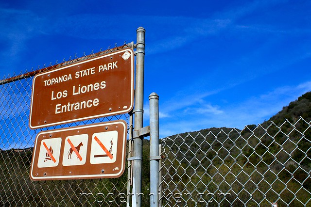
The Los Liones Trail starts on Los Liones Drive in the Pacific Palisades at a clearly marked gate. This is a popular trail, but there’s plenty of free street parking, as well as two spillover lots near picnic areas and restrooms.
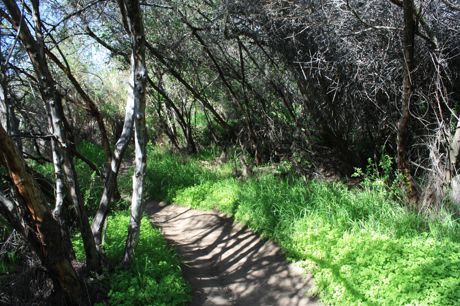
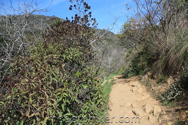
The Los Liones Trail starts out inconspicuously enough, looking like just about any other coastal Southern California trail – but as the single-track route winds its way over several short hills and and through the scrub, it starts to take on a character all its own.
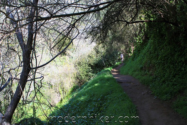
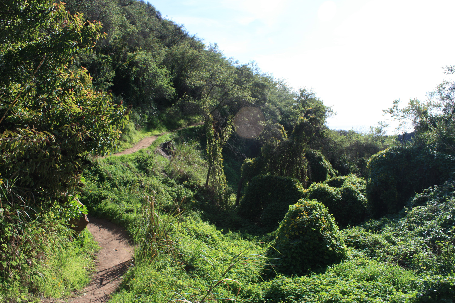
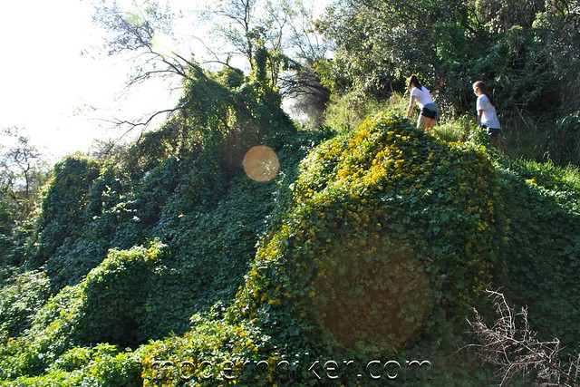
Eventually, the trail gets shadier and incredibly lush. At parts, the entire canyon floor is covered in a carpet of ivy – it looks almost like kudzu – and I bet it’s an amazing place to hike during the spring blooms.
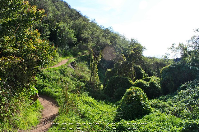
The Los Liones Trail continues for 1.3 miles, gradually opening up to a small viewpoint at the junction with the East Topanga Fire Road.
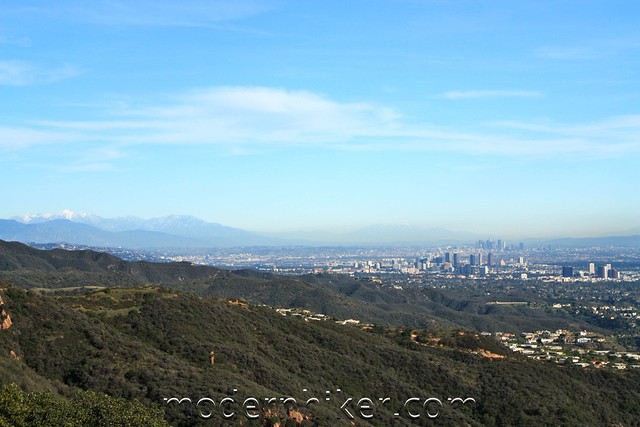
From here, you’ll probably be able to get some great views of the Santa Monica Bay, and perhaps even inland toward downtown, depending on the air quality.
Keep left at the junction to continue on the Fire Road, which now begins a long and seemingly arduous incline as it meanders north through the State Park. The gain is steady and steep in parts, but it’s manageable – about 600 feet in the next mile – and there are plenty of great views to go around. Still, I don’t know if I’d want to be doing this part of the trail on a hot summer day.
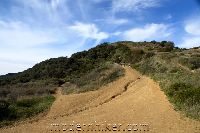
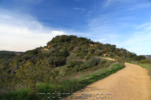
This is the bulk of the trail, and since the terrain isn’t as varied as it was on the Los Liones Trail, it can seem a bit monotonous. If you want to add a bit of variety (and make the trail more strenuous), most of the small peaks and bumps do have use trails that march across the summits instead of avoiding them like the fire road.
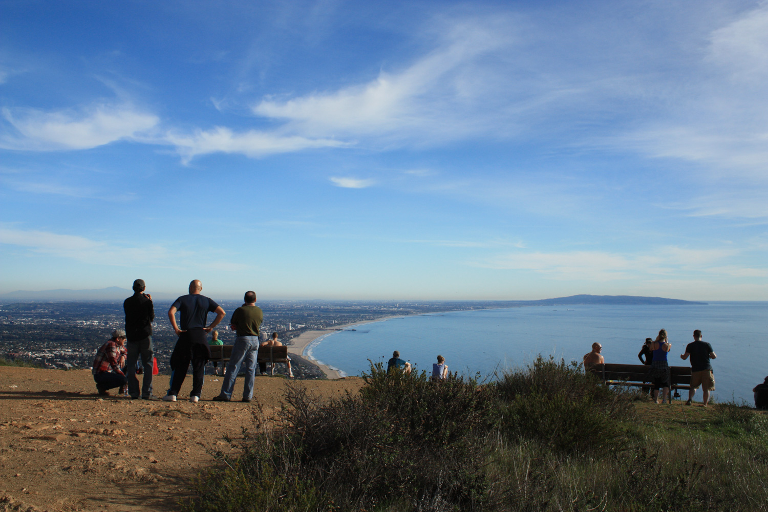
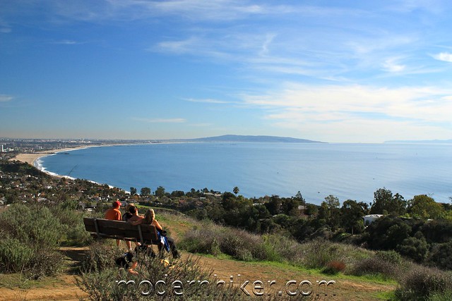
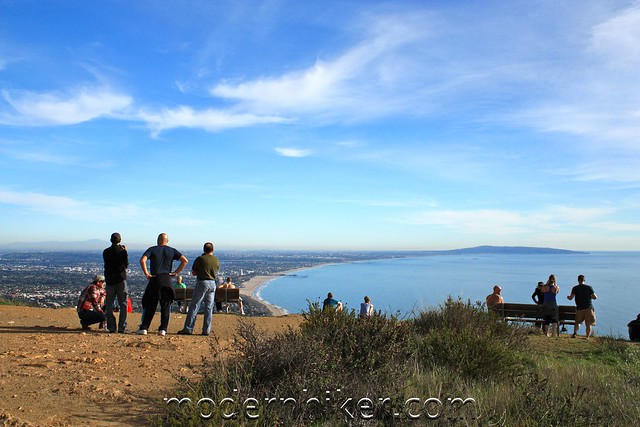
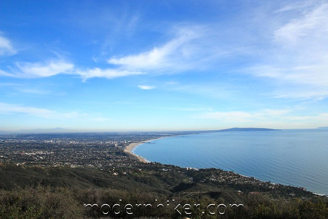
Continue on the fire road until you reach a three-way junction at about 3.2 miles. Take the clearly marked fire road to Parker Mesa for another half mile as it heads west along a ridge. There are a few ups and downs here, but nothing too bad. You’ll also have some great views into the parks more rugged interior, but the main draw are the sights from Parker Mesa itself.
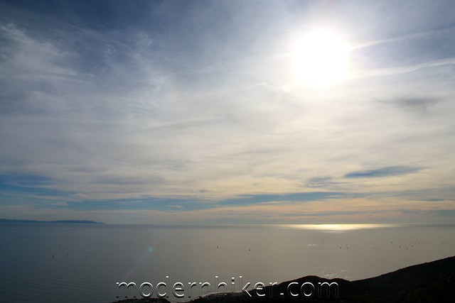
While the Mesa can seem crowded at times, you’ll always have something to look at in the distance. On this day, I could see from Santa Barbara Island all the way to the distant San Bernardinos. The day after a rain, the views would probably be even better.
When you’re done resting and soaking in the views, return back the way you came.


{ 23 comments… read them below or add one }
← Previous Comments
Trails are great even after the rain. Only several wet spots.
Thank you Modern Hiker for this recommendation.
Is this a dog friendly park?
Lanette, dogs are allowed ON LEASH ONLY and only on the fire road trails in Topanga State Park. So you wouldn’t be able to take your canine friend on the Los Liones Trail, but you could hike the fire road to Parker Mesa. Here’s the number for the Topanga Info center: 310-455-2465
I’ll give them a call to see if they have maps for the fireroad trails. Thank you for the additional information.
Long time reader, first time commentator.
I hiked (and ran portions of) this trail this morning in just under three hours. It was the first time I have hiked since moving to LA and I enjoyed it, especially the first half. The climb up the fire roads was harder that I expected and yes, monotonous! It was a great workout though. Coming down I missed the turn back to the Los Liones trail and started down another trail that goes next to some houses, but I knew I was lost pretty quickly, back-tracked, and found the trail.
Sadly it was very hazy, so the views left something to be desired. It was very crowded too; I started at 8:20am and one the way down the Los Liones portion, I often had to step aside to let those coming up the trail pass, including people with dogs, which as you noted, are not supposed to be on this part of the trail. I’ll do it again, but will try to start even earlier in the morning.
CW – welcome to the world of Los Angeles Hiking! :)
Soon, you’ll be setting your alarm for much earlier weekend times than you EVER thought you’d be doing. Some of those trails can get pretty crowded, but they’re still worth the effort. Try re-hiking Los Liones right after a rain, or when we’ve had a little cool weather spell – should help clear up some of that haze for you!
Hey everyone, this hike is featured in the latest Norm’s restaurant tv commercial. Check it out on their website. http://www.normsrestaurants.com
Hikes it yesterday (13 Feb 2011) but with a variation. Started off with a detour to the left from the main trail that has a steep but much shorter climb to the Parker Mesa. This way, it is a punishing hike but much quieter and better cardio. Saw a couple of rattlers on the trail that made it more interesting – both big ones; one must have been longer than 3 feet and 2 to 3 inch diameter. I have hiked the Santa Monica’s for more than 30 years and this was my first time in Los Liones. I ahve hiked many of the trails in the vicinity but a friend introduced me to this one. Truly amazing and thoroughly enjoyable. Highly recommended if you have 3 to 4 hours – and the day is nice.
Hiked this today, April 16, 2011. I enjoyed the pre-fire road portion more because it was a bit hot but the whole hike was cool, great views as it was pretty clear. Was a bit crowded, but what can you expect on sat afternoon. This is only my second hike in the LA area, I enjoyed Echo Mtn + Inspiration Point more, but this one was pretty cool.
Great looking hike. We plan to go there tomorrow. Thanks for the GPX file!
Hiked this trail last weekend. Great trail that depending on your pace is a fun long morning out, or a blistering work-out. Biggest recommendation – get on the trail early. At 8:15 am on the way up the trail was blissfully peaceful and I encountered only a handful of other people. By 10am on my way back down the trail was a lot busier, and now filled with both bikers (on the fire road) and lots of little kids (mostly doing the Los Liones -> fire road and back loop).
Thank you for your review! I thought I had reached the end when I got to the first viewpoint. Luckily, I found your site on my phone and took the fire road to the very top, which was AMAZING! A country mix with Johnny Cash and Ryan Adams was a perfect soundtrack to the hike.
← Previous Comments
You must log in to post a comment.
{ 14 trackbacks }